Field notes: Community mapping for bushfire preparation in St Marys and St Helens, TAS.

Following on from my last post on the community mapping workshop I ran in Kettering, this post describes the next workshops as part of my PhD fieldwork for the topic VGI, community engagement and bushfire preparation. Rather than repeating content from the last post about the research context, and the purpose and description of the workshops, I’ll go straight to discussing how the workshops went and what I observed.

St Marys (2)
Community members from nearby Scamander began by making comments on existing fire service bushfire planning maps.

At the workshop held in St Marys on Saturday 10 people from the area participated, recruited predominantly through Bushfire Ready Neighbourhoods (BRN) networks, a mail-out to a random sample of 150 households, flyers in local shops and word-of-mouth. Participants were varied, including an emergency management consultant, local council member, farmers, and retirees, for instance, providing a diverse group with useful local knowledge to contribute to the mapping activities. Assisting me with this workshop was David Cleaver from the BRN program at the Tasmania Fire Service, and volunteer assistant from the University of Sydney, RJ McDonald.

Participants were also from varying locations around St Marys and not from the town itself, which made the paper mapping activity a little difficult for some. Their homes and the areas they were most familiar with were not in the frame of the paper maps at the scale I had printed them. This is probably quite typical of many rural and bushfire prone areas with many living in smaller places, often on properties, and travelling to a nearby larger town or community when they need to. This limitation of the paper mapping proved to highlight a benefit of digital mapping for participants where capability exists to navigate the map to different locations and zoom in and out to map information a different scales.

As with the workshop in Kettering, even though some initially found the software a challenge, people generally preferred the computer mapping activity. The paper mapping again was recognised as valuable for its low-tech simplicity for older people and those without internet or computer access and for the connections people make by coming together to work on the maps in person. But apart from the common concerns with online mapping (issues of power outages and computer access; a little worry about privacy and malicious intent) most of the comments on the potential use of web mapping and VGI for bushfire preparation in their community were positive. Rather than leading the web mapping myself like last time, this time I gave a laptop or tablet to the groups to map their information themselves, and, after some hesitation, most then engaged with the activity much more beneficially and began to see even greater potential for mapping in their community. They discussed how portable and up-to-date a web map can be and how useful it may be for others in the community perhaps less engaged in more traditional bushfire preparation activities like forums, such as younger people. They discussed how online mapping would be useful for vulnerable groups such as travellers, people new to the area, and those who speak languages other than English.

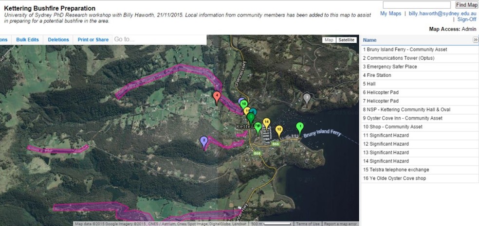
Observing the activities and the things participants chose to map, the content tended to focus on response to a fire event, and people didn’t map a lot about their own preparedness. As you can see on the web map screenshot below people mapped services and assets useful to know in a fire event (they also mapped the same things several times – another consideration with crowdsourcing). While this is certainly useful and clearly did still get people engaged in thinking spatially about their bushfire risk and planning, I also see great potential for even more local, more diverse, and more individually-useful information to be mapped. An example might be the locations of people who have tools available to help others clear vegetation and prepare their homes, or sites of cultural significance, or places important to individual families, or identification of vulnerable people in neighbourhoods who might need extra consideration and assistance in preparing for and responding to a fire. And indeed, some participants excitedly discussed at the end of the workshop how they’d like to carry out similar mapping activities in their local areas with their neighbours to better understand bushfire risk and preparation, which was fantastic to hear! Perhaps the real value of mapping and VGI for bushfire preparation lies in the highly local scenario, to create, map, and share geographic information with those at the neighbourhood scale, rather than the broader aggregated community level where the information may become less relevant to specific individuals. As workshop participants said about the paper mapping versus the computer mapping, there is probably value and merit in both.

St Marys (4)
Community members from nearby Scamander began by making comments on existing fire service bushfire planning maps.
zeemap_stmarys
A screenshot of the (incomplete) community web map.

On Sunday I set up for a workshop in St Helens with help from Suzette Harrison at the BRN and RJ McDonald. I had been told in advance from those at the local council and those previously trying to undertake community engagement works in St Helens that I may not get a large turnout. However I was still pretty disappointed when not a single person arrived for the workshop. After about an hour waiting we called it a day and packed up. I am running four workshops on this trip, partly to explore how community mapping might work in different types of communities, but also as a safety net in case a workshop doesn’t go too well. So this ‘failure’ is disappointing for me given all the time, money, and effort we put in to the event, but it is not detrimental to the research. I’ve got two successful workshops under my belt already with a great amount of information to work with for my thesis, and I still have one more workshop to come this Saturday (December 5th) in Tolmans Hill, which hopefully will also be a useful event.

But of course I have to stop and question why this particular event failed. When I think about the effort I put in to recruiting participants and advertising the event I can’t see much more I could have done. I contacted people who participated in my research in the past about coming to this event (of which 3 confirmed they would attend). I had flyers up in local businesses and community centres. I contacted many groups in the area initially with a general flyer in the mail and later with a personalised email, including the Lions Club, Rotary, day care centres, community development association, schools, arts groups, and local council, to name a few, with a number of these informing me they would share among their networks. I sent information out to a random sample of 150 households in the area. I had the information shared on various local Facebook pages as well as statewide pages like Tasmania Fire Service and Landcare. I also paid for some advertising on Facebook targetted at the St Helens postcode in the week leading up to the event (apparently my $34 spent got my ad to 400 people’s pages). The workshop was also advertised in council newsletters and on the BRN website. Other ideas I had included spots on local radio, in newspapers, or just random door-knocking. But I’m not sure how much difference that would have made.

I was told this community is particularly hard to reach and my experience is similar to others working in this area. In terms of the research, maybe the interest was low because they’ve done a lot of surveys recently? In terms of bushfire preparedness engagement, maybe they generally feel they are prepared enough? Or (worryingly) perhaps they are complacent about the likelihood of a bushfire event impacting them here? St Helens actually experienced a small bushfire event last year where a number of issues arose that I thought might have made this workshop an interesting one. But even a recent event hasn’t triggered widespread interest in fire management in the area (that I or others have seen). Perhaps the idea of giving up four hours on a weekend was just too unattractive (though, I do provide a free lunch!), or perhaps this community was a little too close in proximity to St Marys (about 35 km away; I actually think they are very different communities in a number of key ways so still think there was justification for choosing both). Even still, while I don’t think word of my workshop reached every one of the few thousand residents, I am pretty certain it reached at least several hundred, and it is a bit baffling that not a single person was interested enough to attend. If that is a reflection of their engagement in bushfire preparation broadly, I must say I’m a bit worried about the potential impacts of a bushfire in St Helens, and hopefully further community engagement activities in the future have more success.

12312349_10156501401060019_2104033360_n
The upside of a failed workshop – more sandwiches for me!

Going forward I need to think a bit more about why St Helens didn’t work and relate that to my last workshop in Tolmans Hill. Is there anything I can do differently this week to ensure a good turnout at my last workshop? As I said earlier, I’ve had a good experience overall on the fieldwork so far, and I’m confident that will continue at the next event. Tolmans Hill is a unique place in that it is so close to a large urban centre (Hobart) yet all the houses are surrounded by bush, and Tolmans Hill itself is an entirely residential suburb (no shops, school etc in the immediate area), so I’m looking forward to seeing how folk there respond to the activities and the potential use of VGI and mapping for bushfire preparation in that area.

This fieldwork is funded by the IAWF PhD scholarship and the research is supported by the BNHCRC, Tasmania Fire Service, and the University of Sydney.

Field notes: Community mapping for bushfire preparation in Kettering, TAS

12248170_10156475332675019_3150498197056109497_o
Self portrait: waiting for my first workshop attendees to arrive.

I am currently in Tasmania for the last piece of fieldwork for my PhD research into volunteered geographic information (VGI), community engagement and bushfire preparation. VGI refers to the  voluntary engagement of private citizens in the creation of geographic information, predominantly through sources such as social media, smartphones and inexpensive online mapping tools. VGI represents a shift in the ways geographic information is created, shared, used and experienced and this has important implications for various applications of geospatial data, including disaster management where the social practice of VGI is changing the traditional top-down structure of emergency management and information creation and dissemination.

In Tasmania I am running research workshops with the aim to explore how mapping and sharing local knowledge about bushfire with others in their community may foster community members’ engagement in disaster preparation. Key questions I am considering include:

1) Is the social practice of contributing and reviewing VGI engaging for bushfire preparation?
2) Is the local knowledge and understanding gained from the mapping valuable to communities?
3) Does the activity of mapping together increase community connectedness?
4) Is the map itself an effective medium for collating and sharing community bushfire information?

Workshops are being held in four communities, with the first occurring yesterday in Kettering, South West of Hobart. I will post about the other workshops after they happen, but the remainder of this post will focus on the Kettering workshop.

Approximately 20 people turned up to participate in the workshop, sought through engaging local community groups and community fire networks, flyers distributed on noticeboards in Kettering, and sharing through various social media pages, including the Tasmania Fire Service (TFS) page. The workshop format included introductions and a short presentation about the research and the day’s activities, a paper mapping activity followed by lunch, and a digital mapping activity before participants completed a 15-minute questionnaire before the end of the workshop. My PhD supervisor Dr Eleanor Bruce from the University of Sydney and Lesley King from the Bushfire Ready Neighbourhoods program at TFS assisted in running the workshop.

Kettering (2)
Participants working on their local bushfire preparation map.

The paper mapping activity saw participants in groups of 4-5 marking up paper maps with any information they felt was relevant to bushfire preparation in their  community. Groups were each given a satellite image, topographic map, community protection plan (an official fire service document that outlines ‘nearby safer places’ and other fire relevant information for that community), blank paper, plastic overlays, and a suite of textas, stickers and other stationary and told to map whatever and however they wanted using those resources.

I found it really interesting and kind of enjoyable to wander around observing and discussing with the groups the different things they were choosing to map and how different groups thought about the same places in different ways. They mapped a whole range of things, including (but not limited to) community assets like the local pub, regions of high fire danger, potential places of refuge, roads that would be inaccessible to fire trucks, their homes and where their neighbourhood

Kettering (10)
Paper map completed by one of the groups.

groups were located, what resources were available to help each other prepare, and communication towers. At the end of the exercise groups presented their maps and discussed what they had done with the rest of the participants.


Discussions revealed a number of benefits of the exercise. Some people learned new things about their community in relation to bushfire. Some thought working with others and the

Kettering (13)
Paper map completed by one of the groups.

discussions between community members the mapping generated was the most valuable aspect. Some downfalls of the activity that were raised included the difficulty in keeping a map up-to-date and sharing it with their broader community and the challenge of getting the information ‘out’ of the paper map so it can be used in other ways, e.g. for the fire service.

The second activity involved collating the information from each group into a combined web map (while it is a bit limited in functionality, we used the Zeemaps platform for its simplicity and accessibility). Initially I demonstrated the platform and then participants talked about what they wanted to add as a collective group. Participants were given a URL to the map and asked to contribute on their smartphones or tablets live in the workshop. Not many people took this up and instead preferred me to ‘drive’ the mapping. Some even seemed a little intimidated by the technology (this could be related to demographics – a large portion of the group were retirees. This probably also reflects the kind of people more interested in fire preparation, as well as those more likely to volunteer their time for a research workshop). This resulted in a slightly awkward lull in the activity with many people not having anything to do while others were adding their information to the web map – something to reconsider for the next workshops. However a useful discussion still ensued where a range of benefits and challenges were discussed. The web map was seen as better for zooming in and mapping finer detail information at ‘micro’ scales (e.g. who has a chainsaw on their street), for sharing the map more widely and easily, for maintaining the relevance of information, for the convenience of contributing when/wherever people liked, for the ability to include more detailed comments and photos with points, and for the potential for more to be done with the data (e.g. GIS analyses). Some issues raised included map ownership, privacy, computer illiteracy of some community members, and the potential ‘messiness’ of all the data points together.

workshop_zeemap
A screenshot of the (incomplete) community web map.

While I haven’t analysed any results yet, a cursory look at the survey responses revealed most people saw a lot of potential and positive applications for community mapping to aid in bushfire preparation. In contrast to my observations during the activity, most people seemed to prefer and rated the computer mapping as more useful. They understood the experimental nature of the activity and recognised its limitations in the workshop setting but saw potential for web maps to be a highly valuable tool and resource in their community along the lines of the benefits described above. Overall people were genuinely interested and positive about the research and the potential outcomes. Considering this was the first time I had attended a research workshop of this nature, let alone designed, organised and ran it, I was really happy with how it went. I even got the catering pretty right! While a part of me is looking forward to my short career in event management being over in a few weeks, I’m interested to see how the next workshops in different communities compare. I’ll post an update when they’re done!

This fieldwork is funded by the IAWF PhD scholarship and the research is supported by the BNHCRC, Tasmania Fire Service, and the University of Sydney.

Connecting, informing, and building relationships: notes from the 2015 BNHCRC sustainable volunteering workshop

This week the Bushfire & Natural Hazards Cooperative Research Centre (BNHCRC) Sustainable Volunteering cluster held a workshop to report on research progress, help develop research agendas for 2016, and identify end user utilisation needs. The workshop was hosted by Blythe McLennan, John Handmer and Josh Whittaker at the RMIT Centre for Risk and Community Safety in Melbourne and was attended by researchers, students, and emergency organisation representatives, or end users, from around the country involved in two research projects:

Each project gave a number of presentations which were then discussed. End users offered their thoughts, particularly in breakout sessions centred on improving research utilisation, and a guest presenter, Professor Mary Comerio from the University of California, Berkeley, gave a keynote presentation on resilience, recovery and community renewal.

Presenting my PhD research

For me personally the event was beneficial in a number of ways, including:

  • I was able to present my PhD work to a varied and diverse audience of both people with research backgrounds and those in industry and professional roles (the StoryMap I used for my presentation is here: http://tinyurl.com/nzxrju4). My research investigates the social practice of citizens creating and sharing geographic information in disaster management and the potential use of enabling technologies, such as crowdsourced mapping, social media and smartphones, for increasing community engagement in bushfire preparation. These practices are quite dramatically impacting professional systems and traditional authoritative emergency management. So, to have that breadth of expertise in the field listening to and commenting on my findings was a unique and valuable experience.
  • Being located in different cities, it was an excellent opportunity to catch up on how the broader research my own work is connected to is progressing.
  • I was able to foster existing connections with other researchers in my project (Out of uniform) and its end users, engage with complementary research, and also make new ties important for my current research and my future career.
  • I gained useful insight into the collaborative research process between academia and industry.
  • I gained insight into the challenges of research communication and utilisation, particularly in attempting to align research goals and outcomes with agency needs whilst navigating often-rigid organisation structures and processes. The sometimes-competing nature of these two different systems and ways of operating with different needs and different values at times felt a little akin to my own research, which considers how to align mostly-unstructured citizen information-sharing practices with highly structured formal systems of information control and dissemination in authoritative emergency management. In both cases I think balance is important to gain the most beneficial and optimised outcomes for all parties. A balance of needs and methods to meet those needs, but also a balance of expectations.
Fiona Jennings presenting her PhD research

One minor concern I had during the workshop was that perhaps some other people important in the research needed to be there for these discussions. While it was fantastic to have the interaction of researchers and agencies, I thought, who was missing? Given the out of uniform project in particular is centered on people volunteering and participating in disaster management outside of formal or traditional settings (e.g. emergent community groups, spontaneous volunteers, online activities), I felt more people from community engagement organisations and roles, as well as representatives of these non-traditional volunteering groups would have been extremely valuable contributors in the workshop. PhD student at RMIT Fiona Jennings’ research, for example, is exploring community-led bushfire recovery with really valuable insights even in its early stages. While Fiona’s research clearly has important lessons for emergency agencies, I felt like the real ‘end users’ of her research might in fact be community organisations and community members undertaking disaster recovery. Yet, representatives of those groups unfortunately weren’t as present at the event and hence not included in the discussions.

Overall I thought it was a really useful event and I’m grateful for the opportunity to be involved. My impression is it is quite rare in academic research to have such a close relationship with industry like the BNHCRC provides. While the end users may benefit from the researcher’s findings, we also benefit enormously from having their input throughout the research journey. I’m unlikely the first person to say it, but perhaps ‘end user’ is the wrong term. This workshop alone highlights the important role the agency representatives play in contributing to the research development, progression and utilisation as partners, not simply end users of the outputs, and I hope they remain active and excited about their involvement in the research. I look forward to the next opportunity for us to share more ideas in the future.