With natural hazard and climate-related disasters on the rise, online tools such as crowdsourced mapping and social media can help people understand and respond to a crisis. They enable people to share their location and contribute information.
But are these tools useful for everyone, or are some people marginalised? It is vital these tools include information provided from all sections of a community at risk.
Current evidence suggests that is not always the case.
Online tools let people help in disasters
Social media played an important role in coordinating response to the 2019 Queensland floods and the 2013 Tasmania bushfires. Community members used Facebook to coordinate sharing of resources such as food and water.
Crowdsourced mapping helped in response to the humanitarian crisis after the 2010 Haiti earthquake. Some of the most useful information came from public contributions.
Twitter provided similar critical insights during Hurricane Irma in South Florida in 2017.
In the rush to develop new disaster mitigation tools, it is important to consider whether they will help or harm the people most vulnerable in a disaster.
Who is vulnerable?
Extreme natural events, such as earthquakes and bushfires, are not considered disasters until vulnerable people are exposed to the hazard.
To determine people’s level of vulnerability we need to know:
the level of individual and community exposure to a physical threat
their access to resources that affect their capacity to cope when threats materialise.
Some groups in society will be more vulnerable to disaster than others. This includes people with immobility issues, caring roles, or limited access to resources such as money, information or support networks.
When disaster strikes, the pressure on some groups is often magnified.
The devastating scenes in New Orleans after Hurricane Katrina in 2005 and in Puerto Rico after Hurricane Maria in 2017 revealed the vulnerability of children in such disasters.
Unfortunately, emergency management can exacerbate the vulnerability of marginalised groups. For example, a US study last year showed that in the years after disasters, wealth increased for white people and declined for people of colour. The authors suggest this is linked to inequitable distribution of emergency and redevelopment aid.
We need to ask: do new forms of disaster response help everyone in a community, or do they reproduce existing power imbalances?
Unequal access to digital technologies
Research has assessed the “techno-optimism” – a belief that technologies will solve our problems – associated with people using online tools to share information for disaster management.
These technologies inherently discriminate if access to them discriminates.
In Australia, the digital divide remains largely unchanged in recent years. In 2016-17 nearly 1.3 million households had no internet connection.
Lower digital inclusion is seen in already vulnerable groups, including the unemployed, migrants and the elderly.
Global internet penetration rates show uneven access between economically poorer parts of the world, such as Africa and Asia, and wealthier Western regions.
Representations of communities are skewed on the internet. Particular groups participate with varying degrees on social media and in crowdsourcing activities. For example, some ethnic minorities have poorer internet access than other groups even in the same country.
Research shows participation biases in community mapping activities towards older, more affluent men.
Protect the vulnerable
Persecuted minorities, including LGBTIQ communities and religious minorities, are often more vulnerable in disasters. Digital technologies, which expose people’s identities and fail to protect privacy, might increase that vulnerability.
Unequal participation means those who can participate may become further empowered, with more access to information and resources. As a result, gaps between privileged and marginalised people grow wider.
For example, local Kreyòl-speaking Haitians from poorer neighbourhoods contributed information via SMS for use on crowdsourced maps during the 2010 Haiti earthquake response.
But the information was translated and mapped in English for Western humanitarians. As they didn’t speak English, vulnerable Haitians were further marginalised by being unable to directly use and benefit from maps resulting from their own contributions.
Any power imbalances that come from unequal online participation are pertinent to disaster risk reduction. They can amplify community tensions, social divides and marginalisation, and exacerbate vulnerability and risk.
With greater access to the benefits of online tools, and improved representation of diverse and marginalised people, we can better understand societies and reduce disaster impacts.
We must remain acutely aware of digital divides and participation biases. We must continually consider how these technologies can better include, value and elevate marginalised groups.
High quality and up-to-date maps and geographic information at appropriate spatial scales are vital for effectively preparing for and responding to disasters and humanitarian crises. Risk reduction activities, resource and service delivery, rescue and emergency care, information flows and risk communication, impact assessments and disaster recovery are all dependent on spatial information. In some parts of the world national/government maps, and even Google maps, are inadequate or incomplete, and alternative maps are required.
Public participation in mapping for disaster response and humanitarian crises has increased significantly in the last decade. Sometimes referred to as digital humanitarianism or digital volunteering, or more broadly volunteered geographic information (VGI), the practices of private citizens contributing geographic information for crisis management has been facilitated by technological advancements such as broadband internet and Web 2.0, cloud storage, GPS and smartphones.
Despite limitations, including digital divides and unequal online participation, and data quality concerns, among others, VGI has provided highly useful maps and geographic information to aid in a variety of humanitarian crises, with the use of OpenStreetMap in response to earthquakes in Haiti (2010) and Nepal (2015) as key examples.
What is a mapathon?
OpenStreetMap (OSM) is an online, crowdsourced mapping platform – a bit like Google Maps but created by people like you! Volunteers work independently or collaboratively to add and edit content on the global digital map.
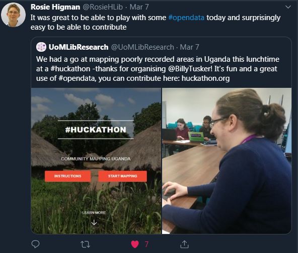
Huts and villages in Uganda being mapped on OpenStreetMapA mapathon is a bit like a ‘mapping party’, whereby people come together to complete a whole load of OSM mapping in a relatively short period of time. The idea being that with everyone working together in just a few hours we can make a BIG contribution! Importantly, mapathons are usually accompanied by free pizza and other fun snacks for the volunteers!
Volunteers work together to add features to poorly-mapped regions
The HCRI humanitarian mapathon
In March 2019 we held our annual mapathon in the Humanitarian and Conflict Response Institute (HCRI), University of Manchester. With colleagues in Geography, we were aiming to contribute to an ongoing project coordinated by Dr Jonny Huck seeking to improve delivery of healthcare and prosthetic limbs to people who were mutilated during conflict in North Uganda. The mapping involved tracing basic information, such as people’s homes, on satellite photographs.
No mapathon is complete without pizza!Around 40 students, academic and support staff from HCRI and across the university volunteered to contribute ~20,000 features (roads, huts, buildings etc) to the poorly mapped region of Acholi in Uganda (Wow!). This open source mapping and data will directly help in reaching people with urgently needed healthcare.
The HCRI humanitarian mapathon, University of Manchester, 2019
Mapping is also valuable to volunteers
“The mapathon was a great way to engage with people who have varying levels of map/geographic information systems (GIS) experience. The process of mapping roads, houses, tracks, buildings etc was very simple. The handouts of how to complete the tasks meant that it was straightforward and you constantly have a source to refer back to. The project as a whole meant that the time I gave felt worthwhile and like I was really making a difference to medical logistic teams in Uganda. I would highly recommend anyone to come along to the next event and get involved; it’s a great way to spend a couple of hours.” – Rach, HCRI MSc student.
“I think it was particularly useful for students of GIS and disasters, in which we critically analysed VGI to participate in the very digital volunteerism we were analysing. It was a more visceral and tangible demonstration of the quirks of geographic information that we were discussing in class (e.g. map projections) even if these particular quirks were relatively trivial. It was nice to bring together people who I’d never seen before across the school and get a feel for what a larger group VGI volunteering effort looks like. I think a lot of people got a fair bit out of it, and I left the event feeling good. The software is super simple and easy to learn and having a few skilled people there to help when problems arose was enough to get everybody up and running.”
– Mike, HCRI MSc student.
Mapathons are enjoyable and rewarding for volunteers
Get involved!
YOU can contribute too!
You don’t need any prior mapping experience, just a computer and an internet connection, and you can map anytime. Visit http://huckathon.org/ to learn more about the North Uganda project and start mapping! Each feature you add to the map could mean a new limb for someone who has been injured by conflict. Better still; why not host your own mapathon?!
The HCRI mapathon was funded by the School of Arts, Languages and Cultures (SALC) Social Responsibility and Cultural Engagement fund, University of Manchester.
Below is a poster I prepared on some work following my postdoc research in 2017, presenting lessons learned from review of information and communication technology initiatives for disseminating agricultural geographic information (AGI) direct to smallholder farmers, who increasingly face short and long term climate shocks and stresses. The poster was displayed at the 21st AGILE conference on Geo-information science, University of Lund, June 2018.
Download the PDF version here: AGILE_poster_Final_June2018
At the conference I was also awarded a Special Recognition Award from the BNHCRC for promoting the organisation and emergency management research in Australia and overseas; effective science communication through exceptional industry relationships, active blogging and social media activities; and a willingness to support the CRC and other students, often leading by example. It was unexpected and I am very thankful for the acknowledgement. True to the spirit of the award, I thought I should include it in a blog post. 🙂
Receiving the award from BNHCRC CEO Richard Thornton
And here is a couple of stills of me presenting taken from a video summary of the conference.
With support of the IAG, I recently attended the IAG annual conference in Adelaide. The theme of the conference, “Frontiers of Geographical Knowledge” was manifest in the jam-packed program, with a number of sessions focusing on the future of the discipline, globally-significant research areas such as natural hazards and disaster risk reduction, and topics reflecting broader social trends, such as greater recognition of the importance and value of indigenous culture, knowledge and research methods.
I found Lauren Rickards’ (RMIT) paper in the slow emergencies session particularly rewarding. Lauren presented on “colliding temporalities, biopolitics and ontologies in the Tasmanian wilderness fires” of 2016. In an engaging presentation she questioned interpretations of the term ‘resilience’ and made insightful comments on media, political and cultural understandings of bushfire in Australia. I also point to the paper by Leah Talbot (CSIRO) as a standout for me. Leah spoke on “Indigenous rights, country and people empowered through the use of Indigenous research methodologies,” where she made a case for the need to “move Aboriginal people from the passenger seat to the driver’s seat” in indigenous-related research.
Lauren was also a panelist in a discussion session on experiences of disaster resilience. This was the first all-female panel I’ve seen at a conference (I’ve certainly seen all-male) – awesome show of equality, IAG! I was also pleased to see numerous speakers, including keynotes, of non-white background as well as a strong Aboriginal presence at the conference, and South Australia’s first openly gay Member of Parliament, The Hon. Ian Hunter, gave the welcome address. As geographers we should be acutely aware of the dominant power-relations at play in our societies, and challenging these to give underrepresented and marginalized groups and individuals equal voices and opportunities seems to me an important contribution that the discipline can make, and this was evident at IAG.
I presented a paper from my PhD research in the session chaired by Eloise Biggs (UWA) on Geospatial information for monitoring socio-environmental risk, alongside Andrew MacLachlan (Southampton) who presented on remote sensing urban expansion in Perth, and Alan Smith (Southampton), who’s paper addressed the development of a temporally dynamic population model for Perth. The paper I presented was co-authored with Joshua Whittaker and Eleanor Bruce and looks at volunteered geographic information (VGI) and disaster risk reduction through the application of participatory mapping in community bushfire preparation in Tasmania. The talk went well and the discussion at the end of the session was one of the best I’ve been a part of, with many in the room, not just the speakers, providing interesting input on a range of related issues raised by the presentations.
Another important aspect of IAG for me was time spent with people discussing research, networking, and making friends, especially as a postgrad and early career researcher. The lunch breaks were good for this, but the conference dinner was great. The IAG travel funds I was awarded helped facilitate the trip through my airfares to attend, but also they went towards accommodation, which I shared with two other early career researchers. I had a great time with these guys and have formed lasting career contacts and friendships, and I’m grateful for the support of the IAG.
Recently I was fortunate to attend the 2015 Esri User Conference in San Diego. It was a fantastically large and exciting event attended by over 16,000 people from 130 countries, showcasing broad and powerful applications of GIS. I felt particularly fortunate to be attending as the 2015 Esri Australia Young Scholar. As described previously on this blog (here) I was awarded the prize for work I completed using GIS to look at patterns of graffiti removal in Sydney, which allowed me to make some comments on the effectiveness of rapid-removal policies and the need to recognize diversity in graffiti practices. Winning this award provided me the opportunity to attend an event that I would not have been able to attend otherwise. It was an incredibly interesting, exciting, useful and inspiring experience. And even better, I got to share the experience with Young Scholar Award winners from other countries around the world! Here is a story map of all their interesting winning projects.
I accepted my Young Scholar Award from Esri founder and president Jack Dangermond.
The opening plenary in particular resonated with me. Jack Dangermond presented exemplary examples of GIS from around the world and spoke about GIS as a process and a framework to apply geography everywhere. He described geography as the science that integrates all the other sciences, from hydrology, geology and climatology to anthropology and sociology, all resting on the spatial dimension – geography as the science of our world. Geography provides the context and the content that will help us understand and address the big challenges of our world today, he said. He spoke about a vision of “geographic enlightenment” where GIS is waking up the world to the power of geography and making for a better future, particularly in the face of global challenges like environment loss, climate change, and overpopulation.
With my research poster in the Esri User Conference map gallery.Panda at San Diego zoo.
Given that most events I attend are quite academic research focused (which I also find very useful!), I appreciated the User Conference had a lot of variety in terms of sessions offered. Technical workshops on software applications, including both desktop GIS, like map projection trouble-shooting or python coding courses, and relatively new web GIS tools and mapping applications, such as story maps for presenting and sharing GIS maps or the collector app and Survey123 for collection of data in the field using smartphones, were really useful. I’m genuinely excited to try some of these new tools for my own research and in my teaching at university. The two-day education conference held before the main conference was also really useful, providing interesting and inspiring discussions about how people are teaching GIS and teaching with GIS around the world. Integrating GIS learning and projects with community needs and community projects, or service-learning, was a key theme.
Overall I found my first Esri UC experience super rewarding. I emphasize first because I’m hopeful I’ll have the opportunity to attend again in the future. It was educational, inspiring, and actually just really fun too. I met some really great people and the social events were equally as enjoyable and worthwhile as the main conference. While in sunny California I was also able to experience some of the San Diego sites, including the famous San Diego zoo, beaches, local watering holes, and major league baseball at Petco Park, where the local Padres had a win against the San Francisco giants!
The 2015 Esri Young Scholars from around the world.
This post is a summary of a paper I had published recently in Geography Compass. The paper is titled A Review of Volunteered Geographic Information for Disaster Management and is co-authored with Dr Eleanor Bruce from the University of Sydney. Here is the citation and link to the full text article:
VGI in disaster management – image courtesy of Billy Haworth
Abstract
The immediacy of locational information requirements and importance of data currency for natural disaster events highlights the value of volunteered geographic information (VGI) in all stages of disaster management, including prevention, preparation, response, and recovery. The practice of private citizens generating online geospatial data presents new opportunities for the creation and dissemination of disaster-related geographic data from a dense network of intelligent observers. VGI technologies enable rapid sharing of diverse geographic information for disaster management at a fraction of the resource costs associated with traditional data collection and dissemination, but they also present new challenges. These include a lack of data quality assurance and issues surrounding data management, liability, security, and the digital divide. There is a growing need for researchers to explore and understand the implications of these data and data practices for disaster management. In this article, we review the current state of knowledge in this emerging field and present recommendations for future research. Significantly, we note further research is warranted in the pre event phases of disaster management, where VGI may present an opportunity to connect and engage individuals in disaster preparation and strengthen community resilience to potential disaster events. Our investigation of VGI for disaster management provides broader insight into key challenges and impacts of VGI on geospatial data practices and the wider field of geographical science.
Introduction
Recent disaster events remind us of the importance of geospatial data and the need for timely and reliable communication in all aspects of disaster management, including prevention, preparation, response and recovery (PPRR). Volunteered geographic information (VGI) provides new opportunities for citizens to create and share geographic information for disaster management. VGI refers to practices of people from the general public creating and sharing their own geographic information, enabled by particular technological advancements, including the growth of Web 2.0, GPS, broadband communication, cloud storage, and mobile devices such as smartphones (see Goodchild 2007).
VGI contributions in disaster management may involve something as simple as somebody posting a relevant photo on social media or it may involve more complex activities, such as the hundreds of volunteers from across the world who worked together using OpenStreetMap to contribute online spatial information for what became the most comprehensive mapping available following the 2010 Haiti earthquake (see Meier 2012).
“A visualisation of the response to the earthquake by the OpenStreetMap community. Within 12 hours the white flashes indicate edits to the map (generally by tracing satellite/aerial photography). Over the following days a large number of additions to the map are made with many roads (green primary, red secondary) added. Also many other features were added such as the blue glowing refugee camps that emerge.” Read more – itoworld.blogspot.com/2010/02/ito-world-at-ted-2010-project-haiti.html
The emergence of VGI has important implications for both individuals and authorities in disaster management, representing numerous opportunities but also significant challenges. In this article we categorize these as being broadly related to data collection and dissemination, data quality and security, data management, and empowerment.
Data Collection and Dissemination
With VGI, the speed and volume of data creation and dissemination has increased dramatically. Information can now be communicated from authorities to communities for disaster management at a fraction of the cost of traditional means of communication. Members of the public can also now create, share, map and communicate information with authorities and with each other in more diverse ways, even if they are not located at the disaster location. As anybody with technology access is now able to contribute, creating disaster related geographic information is no longer just for experts.
The Queensland floods of 2010/2011 saw social media play a critical role, with high numbers of people flooding sites like Facebook and Twitter to share disaster-related information (see Bird, Ling & Haynes 2012). Here, social media facilitated fast and broad information mobility. Posts were re-shared widely, demonstrating the power of social media to promote and propagate messages. This was particularly true for messages of support, but the same mechanisms can also work to spread misinformation or false content.
Rapid uptake of social media during the 2010/11 Queensland floods. Graph produced by Queensland Police Service. “In the 24-hour period following the flash floods, the number of “likes” on the QPS Facebook page increased from approximately 17,000 to 100,000. This same day the QPS Facebook page generated 39 million post impressions, equating to 450 post views per second over the peak 24-hour period.” Read more – https://www.police.qld.gov.au/corporatedocs/reportsPublications/other/Documents/QPSSocialMediaCaseStudy.pdf
Data Quality and Security
Data from private citizens with varying agendas and experience often have quality issues. Studies have reported on important issues of quality control, misinformation, spurious or fraudulent postings, duplicate and doctored images, and the lack of ‘right’ information for disaster relief (see McDougall 2011, Ostermann & Spinsanti 2011). Further, it is often difficult to discern the credibility of online sources. Individual’s physical and online security may be compromised by utilising low-quality VGI. The nature of VGI is that it is often made openly available to the general public. Data of this nature may be particularly compromising during a disaster event, especially when those affected are at their most vulnerable and privacy may be less of a priority than in ‘normal’ circumstances (see Crawford & Finn 2014). For example, a geotagged image of a disaster-impacted property provides useful information to emergency authorities if shared through social media, but that same information about the location of a vulnerable and potentially vacant property may also be available to those with malicious intent. Individuals, authorities and humanitarians should be particularly cautious when using VGI provided through social media (Goolsby 2013), and it should not be assumed that everybody is well informed to manage their own privacy settings online (Crawford & Finn 2014).
Various lines of evidence have been proposed for why the quality of VGI can approach the standards of authoritative data (see Goodchild & Glennon 2010). For example, sites like Wikipedia are proof that crowdsourcing is an effective way to remove errors with large numbers of people reading and verifying information. But how many people are needed for this to be true? And how quickly can information be verified in this way during fast paced emergencies? By its nature user generated content is broadly incomplete, and despite very large volumes of data, bias is not removed. A second example is that advances in positional technology, such as improved GPS in mobile devices, and the increase in familiarity of the public with things like social media, the internet, maps and smartphones means data quality is increased. But this provides no guarantee users consistently operate devices correctly or that they are aware when the technology is not functioning properly. Advances in technology do not necessarily eliminate human error. As researchers continue to seek new applications for these data, innovative methods are needed for empirical validation of the quality and credibility of VGI.
Data Management
Data from the general public presents a number of challenges for data management which are particularly relevant to disaster management. The sheer volume of information provided through VGI is a current obstacle to its efficient use in emergency management, highlighting the need for effective methods to mine, filter, verify, and summarise these data and data sources to ensure credible and relevant content. Various researchers are exploring ways to address this, such as methods to automatically identify relevant key words in Twitter data (Ostermann & Spinsanti 2011). Traditionally, spatial data infrastructures‘ (SDIs) top-down model of supporting digital data access, storage, and sharing is unlike the bottom-up approach on which VGI is established. VGI challenges the assumption that formal organizations are the producers of geospatial information and users are the passive recipients (see Budhathoki, Bruce & Nedovic-Budic 2008). For disaster management, opportunity exists for VGI to augment existing SDIs, providing valuable localised and contextual information for planning decisions and encouraging information flow between communities and authorities.
Due to the higher level of inherent risk to life and property in disaster management decision-making, liability concerns may deter organizations from integrating VGI into their datasets (Shanley, Burns, Bastian & Robson 2013). As websites have a global reach and laws vary widely, liability risks in and across foreign jurisdictions need consideration. VGI site operators, users, and contributors must all have some awareness of the legal and ethical issues that may be triggered by their activities, including issues of intellectual property, liability for faulty information, and defamation (Scassa 2013). Empowerment Through VGI
Empowerment is described as an individual’s capacity to have control over their personal affairs and confront hazard issues while receiving the necessary emergency management support (Bird, Ling & Haynes 2012). It has been argued that VGI empowers individuals to georegister their observations, transmit them through the internet and translate them into readily understood maps and reports (Goodchild & Glennon 2010). But does this indicate VGI can enable individuals to achieve connectedness, more control, and empowerment in disaster management? While VGI may empower some citizens to contribute and engage in disaster management, it also acts to marginalize others. If we consider the digital divide, what is the role of citizens with limiting socio-economic circumstances or those in parts of the world without access to these ‘empowering’ technologies? VGI cannot represent ‘the everybody’ and in fact favours ‘the privileged’, or those with money, access, and time to utilize the technology (see Haklay 2013).
For those that are ‘included’, the use of geospatial data from the crowd has been shown to enhance existing inequalities (see Crawford & Finn 2014). Local information contributed during the 2010 Haiti earthquake crisis was translated into English and subsequently mapped and reported in English, preventing the Kreyòl speakers who messaged for help from benefiting from their own data, thus reproducing unequal power relations between the poor Haitians and the rich who acted on the information (as reported in Crawford & Finn 2014).
Future Research Recommendations
This review highlighted a number of gaps in current academic research around VGI and disaster management. It is recommended that future research consider:
best practices for emergency management agencies to support digital volunteers, and for digital volunteers to support traditional and authoritative disaster management practices
the role of different types of VGI platforms during disasters and comparisons between different types of disasters and whether or not the disaster type has any influence on VGI usage
improving data validation and automatic report summation
more appropriate use of VGI technologies, including geotags (adding location information to online data) and effective hashtags for summarising social media data
VGI in the preparation and prevention phases of disaster management. This review shows that contemporary research on the role of VGI in disaster management predominantly focuses on the response phase of the PPRR cycle. Directing increased attention to the pre-disaster phases may present an opportunity for VGI to foster community engagement and empower individuals to be more directly involved in risk reduction practices.
There is a need for further research on the technical and critical dimensions of VGI and for human geographers to engage with GIScientists to comprehend the implications of these data and data practices for citizens, traditional methods of disaster management, and geography as a discipline more broadly.
In 2010 I completed a Master of Applied Science (Spatial Information Science) at the University of Sydney. Working with Dr. Eleanor Bruce I produced the thesis entitled ‘Graffiti and Urban Space: A GIS Approach’. The work examined spatial and temporal patterns of graffiti occurrence in the City of Sydney local government area, utilizing both council supplied data on graffiti removal, geocoded and analysed in ArcGIS, and graffiti incidence data collected using a handheld GPS and ArcPad. Cluster analysis was performed to determine graffiti removal hotspots. The research presents graffiti as a diverse urban culture, provides evidence for the ineffectiveness of ‘rapid removal’ and ‘zero tolerance’ approaches to graffiti management, and highlights benefits of a GIS approach.
Graffiti in Surry Hills, Sydney, 2011. Photo: Billy Haworth
The purpose of this project was to employ spatio-temporal analysis techniques within a GIS to test some of the popular claims about the effectiveness of rapid removal graffiti policies. The policy informs that rapid removal will deter graffiti writers and reduce overall quantities of graffiti. However, research has suggested that this approach does not reduce overall graffiti but rather triggers changes in location and form. Findings of my research provide evidence for the latter.
This project demonstrated the value of GIS in spatially assessing diverse phenomena in the urban environment. The project provides important quantitative evidence to complement existing qualitatively derived theories. Previously, quantitative work that had been undertaken in this area focussed almost exclusively on criminology. Significantly, my work extended spatio-temporal analysis of graffiti to examine the broader spatial practice of urban graffiti writing as a diverse cultural phenomenon. The project findings contribute to formulating better informed strategies for graffiti management – an important and relevant task for cities the world over.
Haworth, B., Bruce, E., Iveson, K. (2013). Spatio-temporal analysis of graffiti occurrence in an inner-city urban environment. Applied Geography, 38: 53-63.
Abstract:
Graffiti management often presents policy challenges for municipal authorities. However, the inherent diversity of graffiti culture and its role in defining urban space can be neglected when formulating response strategies. This study investigates spatio-temporal trends in graffiti across inner-city Sydney, New South Wales to support alternative perspectives on graffiti and its role in urban landscapes. Graffiti removal incidence records were geocoded to examine graffiti distribution across the City of Sydney Council Local Government Area over a six-month period. Graffiti removal ‘hotspots’ were identified using spatial cluster analysis and shifts in graffiti activity were examined through trend analysis. Specific sites within the Local Government Area were identified as a focus for repeated graffiti removal activities. Finer spatial scale GPS based mapping for a selected graffiti hotspot area in the suburb of Surry Hills showed diversity in graffiti form. While the rate of return may have decreased in the Surry Hills case study, the overall number of graffiti removal incidents increased. Rapid-removal policies can change the location, form and diversity of graffiti encouraging ‘quick and dirty’ forms of graffiti over more complex design works. Spatio-temporal variability in graffiti occurrence across inner-city Sydney highlights the need to consider graffiti as a diverse urban phenomenon when attempting to understand its occurrence and formulate response strategies.


![_SFL6626[1]](https://billyhaworth.files.wordpress.com/2019/04/sfl66261.jpg?w=984&h=656)
![_SFL6567[1]](https://billyhaworth.files.wordpress.com/2019/04/sfl65671.jpg?w=984&h=656)
![_SFL6560[1]](https://billyhaworth.files.wordpress.com/2019/04/sfl65601.jpg?w=984)
![_SFL6517[1].jpg](https://billyhaworth.files.wordpress.com/2019/04/sfl65171.jpg?w=984)