Online tools can help people in disasters, but do they represent everyone? (article in The Conversation)

This article originally appeared in The Conversation.
Billy Tusker HaworthUniversity of ManchesterChristine EriksenUniversity of WollongongScott McKinnonUniversity of Wollongong

With natural hazard and climate-related disasters on the rise, online tools such as crowdsourced mapping and social media can help people understand and respond to a crisis. They enable people to share their location and contribute information.

But are these tools useful for everyone, or are some people marginalised? It is vital these tools include information provided from all sections of a community at risk.

Current evidence suggests that is not always the case.

Online tools let people help in disasters

Social media played an important role in coordinating response to the 2019 Queensland floods and the 2013 Tasmania bushfires. Community members used Facebook to coordinate sharing of resources such as food and water.

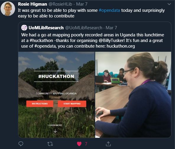
Crowdsourced mapping helped in response to the humanitarian crisis after the 2010 Haiti earthquake. Some of the most useful information came from public contributions.

Twitter provided similar critical insights during Hurricane Irma in South Florida in 2017.

Research shows these public contributions can help in disaster risk reduction, but they also have limitations.

In the rush to develop new disaster mitigation tools, it is important to consider whether they will help or harm the people most vulnerable in a disaster.

Who is vulnerable?

Extreme natural events, such as earthquakes and bushfires, are not considered disasters until vulnerable people are exposed to the hazard.

To determine people’s level of vulnerability we need to know:

  1. the level of individual and community exposure to a physical threat
  2. their access to resources that affect their capacity to cope when threats materialise.

Some groups in society will be more vulnerable to disaster than others. This includes people with immobility issues, caring roles, or limited access to resources such as money, information or support networks.

When disaster strikes, the pressure on some groups is often magnified.

The devastating scenes in New Orleans after Hurricane Katrina in 2005 and in Puerto Rico after Hurricane Maria in 2017 revealed the vulnerability of children in such disasters.

Unfortunately, emergency management can exacerbate the vulnerability of marginalised groups. For example, a US study last year showed that in the years after disasters, wealth increased for white people and declined for people of colour. The authors suggest this is linked to inequitable distribution of emergency and redevelopment aid.

Policies and practice have until recently mainly been written by, and for, the most predominant groups in our society, especially heterosexual white men.

Research shows how this can create gender inequities or exclude the needs of LGBTIQ communitiesformer refugees and migrants or domestic violence victims.

We need to ask: do new forms of disaster response help everyone in a community, or do they reproduce existing power imbalances?

Unequal access to digital technologies

Research has assessed the “techno-optimism” – a belief that technologies will solve our problems – associated with people using online tools to share information for disaster management.

These technologies inherently discriminate if access to them discriminates.

In Australia, the digital divide remains largely unchanged in recent years. In 2016-17 nearly 1.3 million households had no internet connection.

Lower digital inclusion is seen in already vulnerable groups, including the unemployed, migrants and the elderly.

Global internet penetration rates show uneven access between economically poorer parts of the world, such as Africa and Asia, and wealthier Western regions.

Representations of communities are skewed on the internet. Particular groups participate with varying degrees on social media and in crowdsourcing activities. For example, some ethnic minorities have poorer internet access than other groups even in the same country.

For crowdsourced mapping on platforms such as OpenStreetMap, studies find participation biases relating to gender. Men map far morethan women at local and global scales.

Research shows participation biases in community mapping activities towards older, more affluent men.

Protect the vulnerable

Persecuted minorities, including LGBTIQ communities and religious minorities, are often more vulnerable in disasters. Digital technologies, which expose people’s identities and fail to protect privacy, might increase that vulnerability.

Unequal participation means those who can participate may become further empowered, with more access to information and resources. As a result, gaps between privileged and marginalised people grow wider.

For example, local Kreyòl-speaking Haitians from poorer neighbourhoods contributed information via SMS for use on crowdsourced maps during the 2010 Haiti earthquake response.

But the information was translated and mapped in English for Western humanitarians. As they didn’t speak English, vulnerable Haitians were further marginalised by being unable to directly use and benefit from maps resulting from their own contributions.

Participation patterns in mapping do not reflect the true makeup of our diverse societies. But they do reflect where power lies – usually with dominant groups.

Any power imbalances that come from unequal online participation are pertinent to disaster risk reduction. They can amplify community tensions, social divides and marginalisation, and exacerbate vulnerability and risk.

With greater access to the benefits of online tools, and improved representation of diverse and marginalised people, we can better understand societies and reduce disaster impacts.

We must remain acutely aware of digital divides and participation biases. We must continually consider how these technologies can better include, value and elevate marginalised groups.

____________________________________________________________________________________________

____________________________________________________________________________________________
Billy Tusker Haworth previously received funding from the Bushfire and Natural Hazards Cooperative Research Centre.
Christine Eriksen receives funding from the Australian Research Council (DE150100242, DP170100096).
Scott McKinnon has previously worked on projects funded by the Australian Research Council.
University of Wollongong provides funding as a member of The Conversation AU.
University of Manchester provides funding as a member of The Conversation UK.

Mapping together for improved healthcare delivery: the HCRI humanitarian mapathon, 2019

Maps, humanitarianism, and public participation

High quality and up-to-date maps and geographic information at appropriate spatial scales are vital for effectively preparing for and responding to disasters and humanitarian crises. Risk reduction activities, resource and service delivery, rescue and emergency care, information flows and risk communication, impact assessments and disaster recovery are all dependent on spatial information. In some parts of the world national/government maps, and even Google maps, are inadequate or incomplete, and alternative maps are required.

Public participation in mapping for disaster response and humanitarian crises has increased significantly in the last decade. Sometimes referred to as digital humanitarianism or digital volunteering, or more broadly volunteered geographic information (VGI), the practices of private citizens contributing geographic information for crisis management has been facilitated by technological advancements such as broadband internet and Web 2.0, cloud storage, GPS and smartphones.

Despite limitations, including digital divides and unequal online participation, and data quality concerns, among others, VGI has provided highly useful maps and geographic information to aid in a variety of humanitarian crises, with the use of OpenStreetMap in response to earthquakes in Haiti (2010) and Nepal (2015) as key examples.

What is a mapathon?

OpenStreetMap (OSM) is an online, crowdsourced mapping platform – a bit like Google Maps but created by people like you! Volunteers work independently or collaboratively to add and edit content on the global digital map.

_SFL6626[1]
Huts and villages in Uganda being mapped on OpenStreetMap
A mapathon is a bit like a ‘mapping party’, whereby people come together to complete a whole load of OSM mapping in a relatively short period of time. The idea being that with everyone working together in just a few hours we can make a BIG contribution! Importantly, mapathons are usually accompanied by free pizza and other fun snacks for the volunteers!

_SFL6567[1]
Volunteers work together to add features to poorly-mapped regions

The HCRI humanitarian mapathon

In March 2019 we held our annual mapathon in the Humanitarian and Conflict Response Institute (HCRI), University of Manchester. With colleagues in Geography, we were aiming to contribute to an ongoing project coordinated by Dr Jonny Huck seeking to improve delivery of healthcare and prosthetic limbs to people who were mutilated during conflict in North Uganda. The mapping involved tracing basic information, such as people’s homes, on satellite photographs.

_SFL6560[1]
No mapathon is complete without pizza!
Around 40 students, academic and support staff from HCRI and across the university volunteered to contribute ~20,000 features (roads, huts, buildings etc) to the poorly mapped region of Acholi in Uganda (Wow!). This open source mapping and data will directly help in reaching people with urgently needed healthcare.

_SFL6517[1].jpg
The HCRI humanitarian mapathon, University of Manchester, 2019

Mapping is also valuable to volunteers

“The mapathon was a great way to engage with people who have varying levels of map/geographic information systems (GIS) experience. The process of mapping roads, houses, tracks, buildings etc was very simple. The handouts of how to complete the tasks meant that it was straightforward and you constantly have a source to refer back to. The project as a whole meant that the time I gave felt worthwhile and like I was really making a difference to medical logistic teams in Uganda. I would highly recommend anyone to come along to the next event and get involved; it’s a great way to spend a couple of hours.
– Rach, HCRI MSc student.

“I think it was particularly useful for students of GIS and disasters, in which we critically analysed VGI to participate in the very digital volunteerism we were analysing. It was a more visceral and tangible demonstration of the quirks of geographic information that we were discussing in class (e.g. map projections) even if these particular quirks were relatively trivial.
It was nice to bring together people who I’d never seen before across the school and get a feel for what a larger group VGI volunteering effort looks like. I think a lot of people got a fair bit out of it, and I left the event feeling good. The software is super simple and easy to learn and having a few skilled people there to help when problems arose was enough to get everybody up and running.”
Mike, HCRI MSc student.

Mapathon_tweet
Mapathons are enjoyable and rewarding for volunteers

Get involved!

YOU can contribute too!
You don’t need any prior mapping experience, just a computer and an internet connection, and you can map anytime. Visit http://huckathon.org/ to learn more about the North Uganda project and start mapping! Each feature you add to the map could mean a new limb for someone who has been injured by conflict. Better still; why not host your own mapathon?!

The HCRI mapathon was funded by the School of Arts, Languages and Cultures (SALC) Social Responsibility and Cultural Engagement fund, University of Manchester.

Geographic information and communication technologies for supporting smallholder agriculture. (#AGILE2018 conference poster)

Below is a poster I prepared on some work following my postdoc research in 2017, presenting lessons learned from review of information and communication technology initiatives for disseminating agricultural geographic information (AGI) direct to smallholder farmers, who increasingly face short and long term climate shocks and stresses. The poster was displayed at the 21st AGILE conference on Geo-information science, University of Lund, June 2018.
Download the PDF version here: AGILE_poster_Final_June2018

AGILE_poster_Final_June2018

Contributions of volunteered geographic information (VGI) to community disaster resilience: The good, the bad, and the uncertain. (#GISRUK2018 conference poster)

Below is a poster I prepared on some work following my PhD research into volunteered geographic information and disaster risk reduction. The work is co-authored by Eleanor Bruce and Josh Whittaker. It was displayed at the 26th GIScience Research UK Conference, University of Leicester, April 2018.
Download the PDF version here: Haworth et al_GISRUK2018_poster

Haworth et al_GISRUK2018_poster

Using participatory mapping to increase community engagement in bushfire preparation (AFAC/BNHCRC 2016 conference poster + presentation + award)

Recently I was fortunate to attend the annual Australasian Fire and Emergency Service Authorities Council/Bushfire & Natural Hazards Cooperative Research Centre (AFAC/BNHCRC) conference in Brisbane, Queensland. I gave an oral presentation and presented a poster from some of my PhD research. And here the poster is for you to look at for free and keep forever!

Download Pdf: haworth_2016_afac_poster
The extended abstract for the oral presentation is also available to download: haworth_afac16_extended-abstract

haworth_2016-raf_afac_poster

At the conference I was also awarded a Special Recognition Award from the BNHCRC for promoting the organisation and emergency management research in Australia and overseas; effective science communication through exceptional industry relationships, active blogging and social media activities; and a willingness to support the CRC and other students, often leading by example. It was unexpected and I am very thankful for the acknowledgement. True to the spirit of the award, I thought I should include it in a blog post. 🙂

And here is a couple of stills of me presenting taken from a video summary of the conference.
slide1

slide2